
Walton County: From Wilderness to World-Class Destination
Established in 1824, Walton County began as a vast 2,900-square-mile territory named for Colonel George Walton, a key figure in early Florida and son of a Declaration of Independence signer. Its early history was shaped by the Euchee and Creek Indians and settled by Scottish pioneers who established farming and timber as the area's first economic engines. The arrival of the railroad in the 1880s transformed the landscape further, leading to the birth of DeFuniak Springs and the renowned Florida Chautauqua Assembly, which turned the county into a winter destination for education, arts, and culture for thousands of visitors.
Today, the county’s modern map reflects a unique blend of this storied past and its vibrant present. From the rolling hills of the north—home to Florida’s highest natural point—to the emerald waters and rare coastal dune lakes of the south, Walton County remains a place of remarkable geographic and cultural diversity. Whether you are tracing the historic rail lines that built our towns or exploring the growing beach communities, this map serves as a bridge between the generations of pioneers who first blazed these trails and the millions who now call this beautiful region home
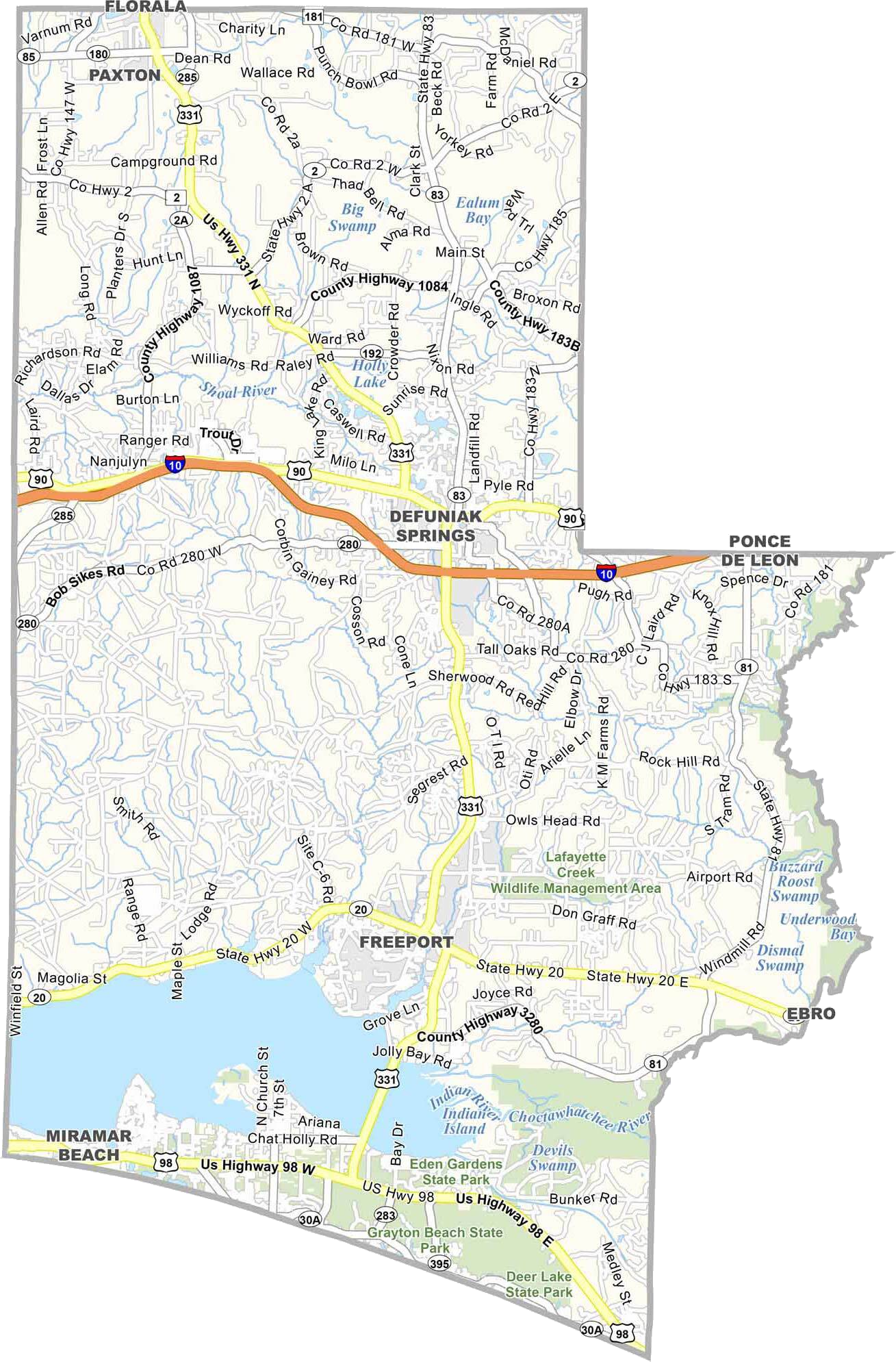
Photo provided courtesy of US County Maps - https://uscountymaps.com/walton-county-map-florida/